
City of Greater Geelong
2 Southern Plants plants are on this council's 20 lists. Change council
Southern Plants plants on these lists
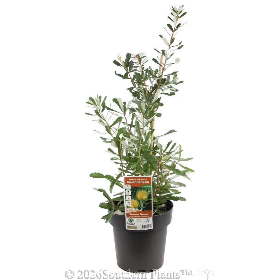 Silver Banksia
Banksia marginata Zone 1: Eastern Bellarine Plains, Zone 2: Mt Bellarine volcanic soils, Zone 3: Central Bellarine Hills +13 more
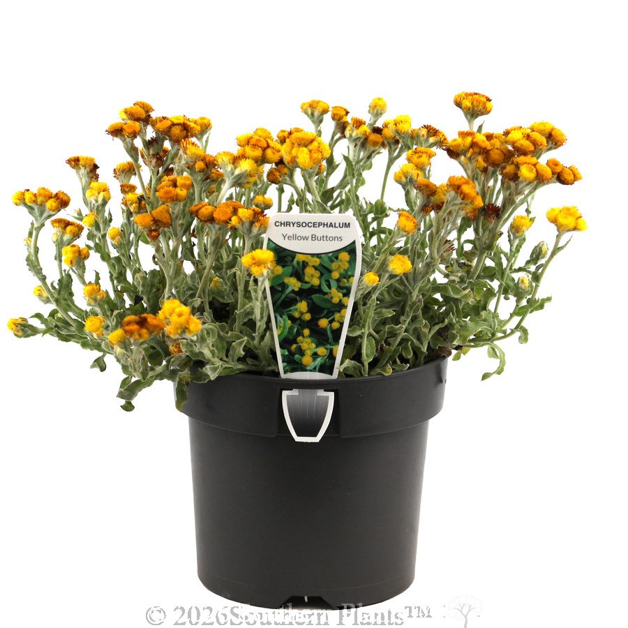 Yellow Buttons
Chrysocephalum apiculatum Zone 1: Eastern Bellarine Plains, Zone 3: Central Bellarine Hills, Zone 6: Marshall Plains and Waurn Ponds Flats +8 more
The council's lists
- Local native planting list Zone 10: Barwon and Moorabool valleys, rivers and major creeks · 45 plants Main indigenous trees and shrubs that naturally grew in this zone. The council's zone map shows which zone your property is in.
- Local native planting list Zone 11: Stonehaven, Fyansford and western basalt plains · 34 plants Main indigenous trees and shrubs that naturally grew in this zone. The council's zone map shows which zone your property is in.
- Local native planting list Zone 12: Batesford granitic and tertiary sands · 33 plants Main indigenous trees and shrubs that naturally grew in this zone. The council's zone map shows which zone your property is in.
- Local native planting list Zone 13: Meredith and Steiglitz area · 48 plants Main indigenous trees and shrubs that naturally grew in this zone. The council's zone map shows which zone your property is in.
- Local native planting list Zone 14: Colluvial plains east of the Brisbane Ranges and You Yangs · 31 plants Main indigenous trees and shrubs that naturally grew in this zone. The council's zone map shows which zone your property is in.
- Local native planting list Zone 15: You Yangs granite · 37 plants Main indigenous trees and shrubs that naturally grew in this zone. The council's zone map shows which zone your property is in.
- Local native planting list Zone 16: Werribee Plains · 20 plants Main indigenous trees and shrubs that naturally grew in this zone. The council's zone map shows which zone your property is in.
- Local native planting list Zone 17: Anakie East, Lovely Banks, Corio basalt plains · 24 plants Main indigenous trees and shrubs that naturally grew in this zone. The council's zone map shows which zone your property is in.
- Local native planting list Zone 18: Werribee Plains rivers and watercourses · 29 plants Main indigenous trees and shrubs that naturally grew in this zone. The council's zone map shows which zone your property is in.
- Local native planting list Zone 19: Coastal zones of the Geelong region · 38 plants Main indigenous trees and shrubs that naturally grew in this zone. The council's zone map shows which zone your property is in.
- Local native planting list Zone 1: Eastern Bellarine Plains · 32 plants Main indigenous trees and shrubs that naturally grew in this zone. The council's zone map shows which zone your property is in.
- Local native planting list Zone 2: Mt Bellarine volcanic soils · 19 plants Main indigenous trees and shrubs that naturally grew in this zone. The council's zone map shows which zone your property is in.
- Local native planting list Zone 3: Central Bellarine Hills · 45 plants Main indigenous trees and shrubs that naturally grew in this zone. The council's zone map shows which zone your property is in.
- Local native planting list Zone 4: Lower rear dune communities · 33 plants Main indigenous trees and shrubs that naturally grew in this zone. The council's zone map shows which zone your property is in.
- Local native planting list Zone 5: Moolap Plains · 24 plants Main indigenous trees and shrubs that naturally grew in this zone. The council's zone map shows which zone your property is in.
- Local native planting list Zone 6: Marshall Plains and Waurn Ponds Flats · 37 plants Main indigenous trees and shrubs that naturally grew in this zone. The council's zone map shows which zone your property is in.
- Local native planting list Zone 7: Geelong, Grovedale, Waurn Ponds Flats · 28 plants Main indigenous trees and shrubs that naturally grew in this zone. The council's zone map shows which zone your property is in.
- Local native planting list Zone 8: Mount Duneed and surrounding basalt flows · 30 plants Main indigenous trees and shrubs that naturally grew in this zone. The council's zone map shows which zone your property is in.
- Local native planting list Zone 9: Barrabool Hills · 27 plants Main indigenous trees and shrubs that naturally grew in this zone. The council's zone map shows which zone your property is in.
- Weed / do not plant City of Greater Geelong environmental weeds · 39 plants Environmental weeds listed by the City of Greater Geelong (list dated 2008, republished 2022).
Lists marked "local native planting list" are for a vegetation type (EVC). The council's website or Victoria's NatureKit map shows which one your property is in.
1 of our plants is named on this council's weed list, and 7 more belong to a species or genus it lists
Named on the list
- Pincushion Hakea Hakea laurina
These are listed only by their species or genus, not by variety. Some varieties are sterile or set little seed, so they may not spread like the wild plant. Ask your local nursery or garden centre if you're unsure. Each plant's page has growing tips.
The list names the species Agapanthus praecox, not these varieties
- Agapanthus Baby Periwinkle Agapanthus praecox ssp. orientalis 'Baby Periwinkle'
- Agapanthus Baby Pete Agapanthus praecox ssp. orientalis 'Baby Pete'
- Agapanthus Golden Pixie Agapanthus praecox ssp. orientalis 'Baby Pete Variegated'
- Agapanthus Tinkerbell Agapanthus praecox subsp. orientalis 'Tinkerbell'
The list names the species Hakea laurina, not this variety
- Hakea Stockdale Sensation Hakea laurina hybrid 'Stockdale Sensation'
The list names the species Polygala myrtifolia, not this variety
- Polygala Poly Ball Polygala myrtifolia x oppositifolia 'Poly Ball'
The list names the species Leptospermum laevigatum, not this variety
- White Wave Tea Tree Leptospermum laevigatum 'White Wave'
Search another council
Many councils publish lists of local native plants to grow, plants for nature strips, and weeds to avoid. Enter your postcode to see your council's lists and the Southern Plants plants that are on them.